Technical details
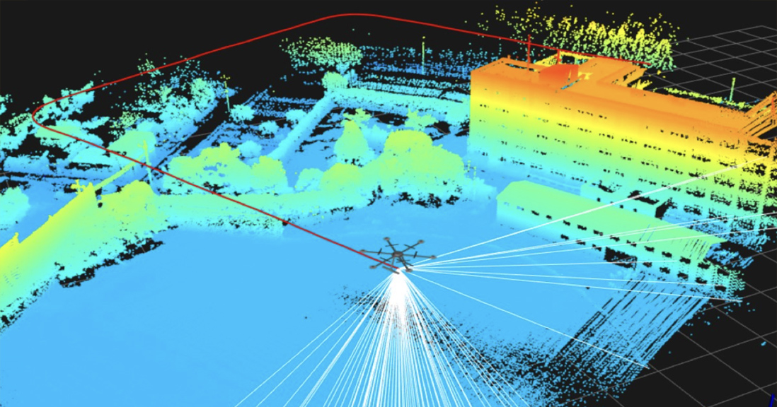
GNSS-LiDAR is a 3D mapping system using a drone with a LiDAR (Light Detection And Ranging) sensor. The Precise position and attitude data of the drone is required for the LiDAR 3D mapping. Heavy-weight and expensive IMUs (Inertial Measurement Unit) are typically used for estimating position and attitude. The proposed technology uses the multiple GNSS (Global Navigation Satellite System) to estimate the precise position and attitude of the drone (the positioning accuracy is 1 cm and the attitude accuracy is 0.1°) without using the IMU. We evaluated the accuracy of 3D mapping using the proposed system. From the results, the proposed system can measure 3D coordinate within 5 cm accuracy. This technology can drastically reduce the cost of the LiDAR 3D mapping and it is expected to be used to many applications.Movies