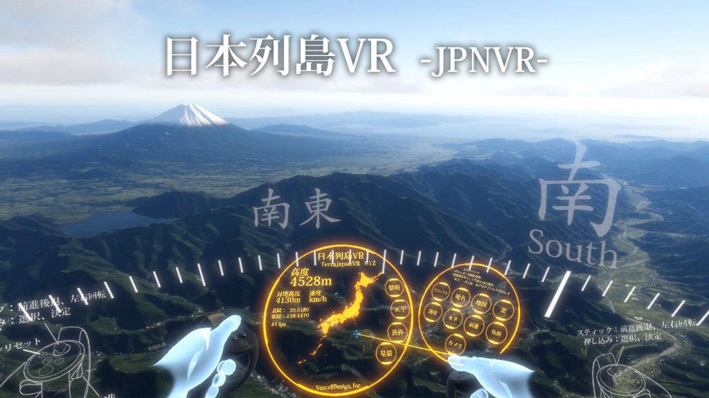
Technical details
I extract information such as altitude, coastline, road etc. from basic map information issued by the Geographical Survey Institute and draw it in real time after conferring parametric material by 3D CG shader technology.Unlike the conventional terrain viewer using satellite photographs, focusing on realistic representation such as reflection of water surface, it is characterized by being able to change the amount of snow and sea level rise in real time.
In addition, it is designed so that we can experience Japan nationwide seamlessly and comfortably with VR.
Movies